Mt. Baldy
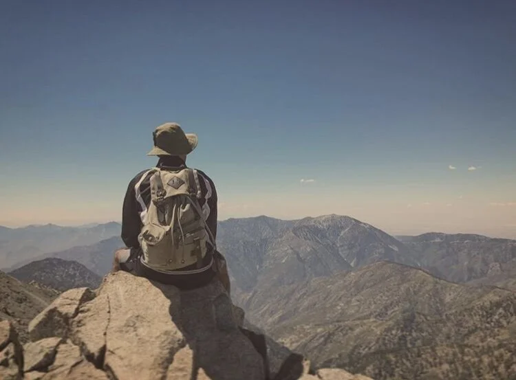
Location: Mt. Baldy, Southern California Elevation - 10,064 ft
More info:
Best Trail to summit: Start at Manker Flats Trailhead and take Baldy Bowl Ski Hut Trail to Devils Backbone Trail back down to Manker Flats Trailhead
Type of Trail: Loop
Mileage: ~11 miles round trip
Total Elevation Gain: ~3,900feet total elevation gain
Mt Baldy Trailhead: Manker Flats Trailhead
Estimated Time to complete: 6-8 hours, day hike
Difficulty: Strenuous
Experience: I embarked on this hike with my brother, and one of my best buddies at the time. It was definitely an intense hike, although I was well conditioned at the time, and didn’t find much difficulty accomplishing the feat. however, my buddy was a personal trainer and despite being in fairly good shape, his conditioning was not sufficient to complete the hike at this elevation, about a half mile to the peak he began to feel lightheaded and his legs began to feel the effects, he was unable to continue any further. At this point, he took a break and turned back to give him ample time to get back down the summit without holding us up. My brother and I both have asthma and were able to complete the entire trek, without much of an issue, just a break here or there, and we had our lunch at the peak. Overall it was a really cool experience, and just being able to say you climbed to the top of Mount Baldy is an accomplishment in itself. I would recommend this trail to anyone that would like to push themselves on a hike or anyone looking to train at high altitudes. (9/10).